
THE Bureau of Meteorology warns minor to major isolated flooding is possible from Sunday into early next week for parts of north-western and central western New South Wales catchments.
Further coastward, rainfall associated with Tropical Cyclone Alfred is likely to cause rapid and dangerous river rises and extensive moderate to major flooding along the New South Wales northern rivers and mid-north coast from late Friday through to the weekend. Rainfall may extend inland during Sunday into early next week and may result in minor to major flooding in the north-west and central-west catchments from Sunday.
Catchments in the northern rivers are wet. Catchments in the north-west and central-west are relatively dry.
There is a chance that the flood watch area may expand further over the coming days as certainty develops about the movement of the system into next week.
The location of the heaviest rainfall and most severe flooding will depend on the track of Tropical Cyclone Alfred.
The recent slower movement of TC Alfred is likely to delay the onset of the heaviest rainfall, with heavy and locally intense rainfall forecast to increase Friday night and into the weekend over northern New South Wales. The heaviest rainfall will be south of the Tropical Cyclone track.
With significant falls of rain forecast across Moree Plains Shire and the Upper Horton catchment during the next few days, NSW SES on Friday advised people in Gravesend and surrounding districts, including Horton River communities, to “stay informed” about predicted possible minor to moderate flooding on the Gwydir River.
These are not flood warnings but a “heads-up” for residents to stay informed.
Similar advice has been issued to Gunnedah and Tamworth districts.
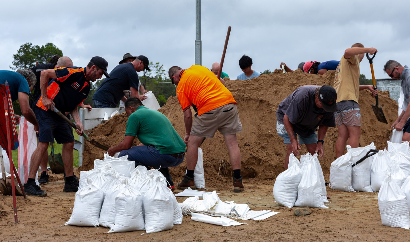
Sand-bagging at Coffs Harbour (Image: NSW SES).
NSW SES also issued Watch and Act advice to Deepwater, Glen Innes, Georges Creek, Glencoe, Llangothlin, Guyra, Aberfoyle and Ebor, recommending people stay indoors.
Landholders are encouraged to consider moving livestock and pumps to higher ground.
As Tropical Cyclone Alfred makes landfall overnight, Bom’s senior meteorologist Jonathan How said Friday’s rainfalls across New South Wales and Queensland were steadily building.
“We are seeing rainfall totals building across parts of northern New South Wales reaching up to 100mm since 9am (Friday) and many other locations are seeing those totals gradually build, including the Casino areas, Dorrigo to the south, Grafton and also Lismore,” Mr How said.
“North of the border, we’ve seen rainfall totals build across eastern parts of the Darling Downs as well as around the Brisbane areas and the Gold Coast.”
Tropical Cyclone Alfred is moving slowly in a westerly direction at around seven kilometres an hour.
“Because the cyclone is so slow-moving, it does give more time for those impacts to really build,” Mr How said.
“We are seeing very significant waves and coastal erosion across Queensland and New South Wales and that’s been prolonged by how slow the cyclone is moving,” Mr How said.
“It’s also given more rainfall to parts of northern New South Wales, and we’ve seen those build over the last day or two.”

Mr How said tracking has the cyclone making landfall on Saturday.
“The current track map has Alfred reaching the outer islands off Brisbane early Saturday morning as a category 2 system, and we are expecting a crossing during the late morning, and that could even push into the afternoon,” Mr How said.
“There is the potential for intense rainfall, and we’ll see some rivers and creeks rise and there are a number of warnings for flooding already current (for the northern New South Wales and south-east Queensland coastal areas).
“As we start to approach the crossing early Saturday morning, we will see very heavy to intense rainfall for anywhere south of the centre of the cyclone, and that includes Brisbane, the Gold Coast and down into the northern parts of New South Wales.
“When it does start to get towards the crossing, the cyclone will become very slow moving and that will mean an extended period of time of heavy rainfall,” he said.
“We’ll also see significant winds coming through, especially around the centre of the cyclone itself. These winds may be sustained for quite a long period of time.
“As the cyclone gets closer, we’ll also see the storm surge come through. That means a lot of water pushing onto the coast, and we will see inundation of some of those low-lying suburbs and significant coastal erosion persisting,” Mr How said.
More than 29,000 dwellings are currently under watch and act or emergency warnings, with about 15,000 people across the state already ordered to evacuate.
NSW SES assistant commissioner Nicole Hogan said it is important to follow emergency warnings and evacuation advice.
“Although Cyclone Alfred is moving slower than expected, this remains a serious and dangerous weather event,” Ms Hogan said.
“The community must remain vigilant and stay informed. If you are in an evacuation warning area, act now before conditions deteriorate.”
“Cyclone Alfred has already caused significant damage, leaving many homes and businesses without power.”
View the full warning: https://hazardwatch.gov.au/a/CIQFIQ
Download the Hazards Near Me App and set up ‘Watch Zones’ to receive warnings in real time: https://www.nsw.gov.au/emergency/hazards-near-me-app
For emergency assistance during a flood, storm or tsunami, call the NSW SES on 132 500. In a life-threatening emergency, call Triple Zero (000).

